Frontend Zoom/Pan with CSS

The off-the-shelf Super Interactive Maps plugin is using Google GeoChart API, unfortunately the zooming buttons and functions are not available in this API by Google as per link here  https://stackoverflow.com/questions/10142232/google-charts-geochart-zoom-in-closer

However, the only way we can add zoom at this moment is using CSS and JavaScript functions that will zoom existing map provided by Google.

Important Notice: The source map is coming from Google and the quality of the map is subject to Google improvement and will be out of our control. We just add this zoom capability using CSS and JavaScript.

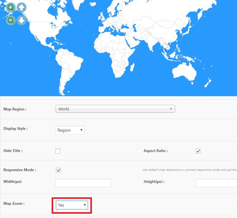
In Patch 1.8, you will have the option to set Map Zoom to Yes when adding/editing maps via the administrator.

Super Interactive Maps CSS Zoom Function Administrator

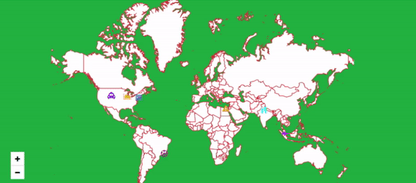
When the Map Zoom is activated, at frontend, your map will have a zoom icons at the bottom left which lets you zoom the map using CSS. You can also pan and move the map using your finger on PC, laptops, mobile devices and tablets.

Super Interactive Maps CSS Zoom and Pan Feature

VIEW DEMO

Hide Other Regions

You can show only highlighted region and hide other regions like below, more details available in this knowledge base article here.

VIEW DEMO

Belgium

A map of Belgium shown by regions, click on the each region to view interactive rich content.

VIEW DEMO

World Map with Clickable Continents

Here’s a map example of World Continents, you can customize the style and colors for each continent and add interactivity such as linking to a new link or add interactive pop up to showcase rich content for each continent.

continents

For more info, refer to the Conteint Hierarchy and Codes from Google GeoChart API

VIEW DEMO

Middle East Map

Some map regions are not available in Google GeoChart API yet, however, you can create custom cropped map by using instructions below:

1. Create a New Map

2. You can use the controls on the top left of the Map Previewer (i.e Zoom In/Out, Pan and adjust height)

Crop

VIEW DEMO